
What to see by boat between Vilanova and Illa de Arousa
The stretch of sea between Vilanova de Arousa and the island is one of Galicia's densest in history, nature and gastronomy. We cover it point by point — what you see left and right.
The crossing between Vilanova de Arousa and the Illa de Arousa is barely 15 minutes of navigation, but it's a dense 15 minutes: mussel rafts left and right, the 2-km bridge linking island and mainland, the Punta Cabalo Lighthouse on the horizon, traditional fishing houses, Mount Con do Forno as reference. Here's the point-by-point guide.
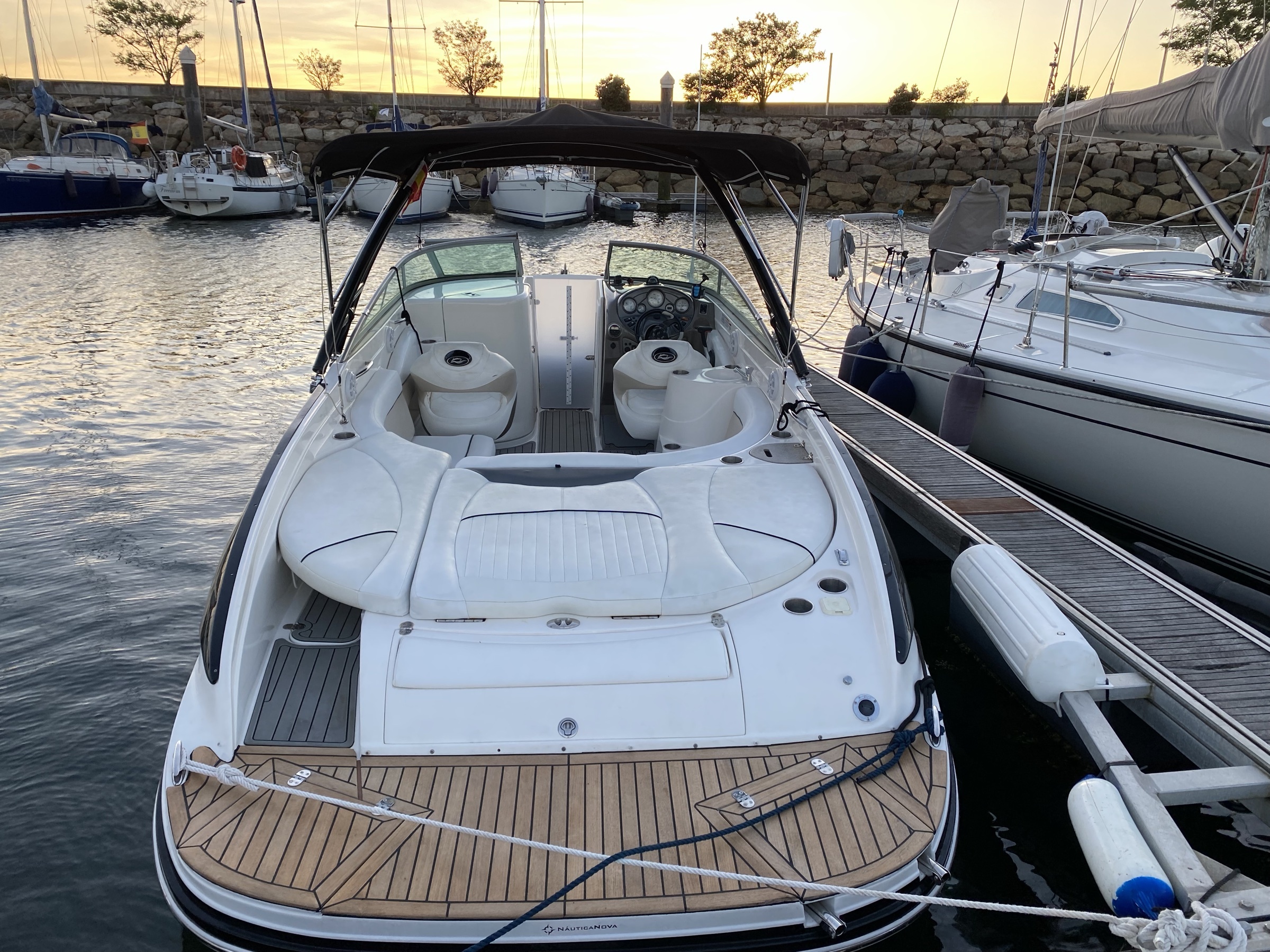
Vilanova port: the starting point
You set off from Vilanova de Arousa marina, a fishing and pleasure port that keeps local character. Unlike Sanxenxo or Vigo, you still see fishermen unloading catches at dawn and active fish markets. Real Galicia, not tourist postcard.
As you sail away, looking back you see the silhouette of Vilanova's old town: the Valle-Inclán House-Museum (the writer was born here in 1866), the historic Albariño cellars, the 18th-century San Cibrán church.
To port: the southern shore
Heading NE, to port (left) you have the Vilagarcía and Carril coast, known for its Carril clams — protected designation of origin for some of the world's best clams. With luck you see shellfish gatherers working the beaches at low tide.
Further away, on clear days, you spot Mount Lobeira (296 m) and Cortegada island (which we visit on some routes — laurel forest, National Park).
To starboard: the island approaches
To starboard (right) the Illa de Arousa grows larger every minute. First things visible:
- Water tower (visual reference from sea).
- The 2-km bridge linking island to mainland — opened in 1985, one of Spain's longest maritime bridges for years.
- Main village of the island: O Xufre, with its fishing harbour and whitewashed houses hugging the sea.
The mussel-raft polygon
Here begins the iconic part of the route. The Arousa estuary produces over 50% of the world's mussels, on floating platforms called bateas. There are over 2,300 bateas in the estuary, grouped in "polygons" — designated zones.
We cross the polygon between Vilanova and the island at slow speed. What you see:
- Each batea is a 27 × 27 m square platform, floating on fibre buoys.
- From each batea hang 500 ropes up to 12 m deep, where mussels are cultivated.
- Some have seagulls perched and cormorants diving among the ropes.
- The bateeiros (mussel-farm workers) operate small boats — you see them harvesting manually.
It's one of the most unique aquatic landscapes in the world. Nowhere else has this at this scale.
Midpoint: panoramic view
Reaching the centre of the crossing, pause for a moment (we usually do). The 360° perspective is brutal:
- Behind (south): Vilanova old town, mountains beyond.
- Ahead (north): Illa de Arousa with the Punta Cabalo Lighthouse peeking to the right.
- Port (west): toward O Grove and A Toxa, Mount Siradella in the distance.
- Starboard (east): east face of the island, Cabo Lobeira distant.
If you take photos, this is the point. With a drone, the image is the cover of any tourist postcard.
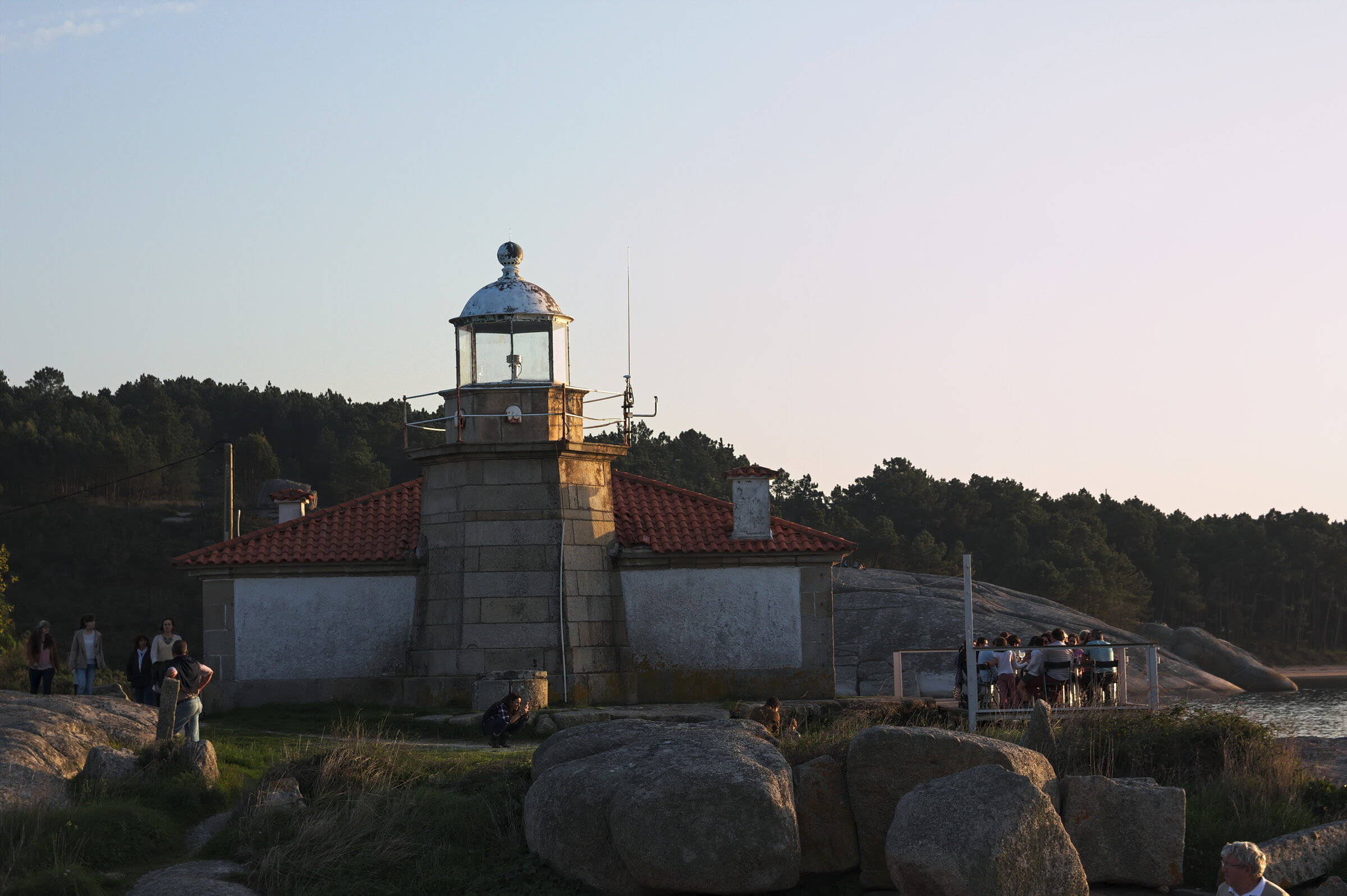
Approaching the island: the lighthouse
As you round the island via the north, the Punta Cabalo Lighthouse appears, first lit in 1853 (see the dedicated lighthouse guide). We anchor 50 m from the lighthouse base if tide allows, and dive in for snorkel or SUP.
The waters around the lighthouse are among the clearest in the estuary — rocky bottom, up to 5 m visibility in August-September.
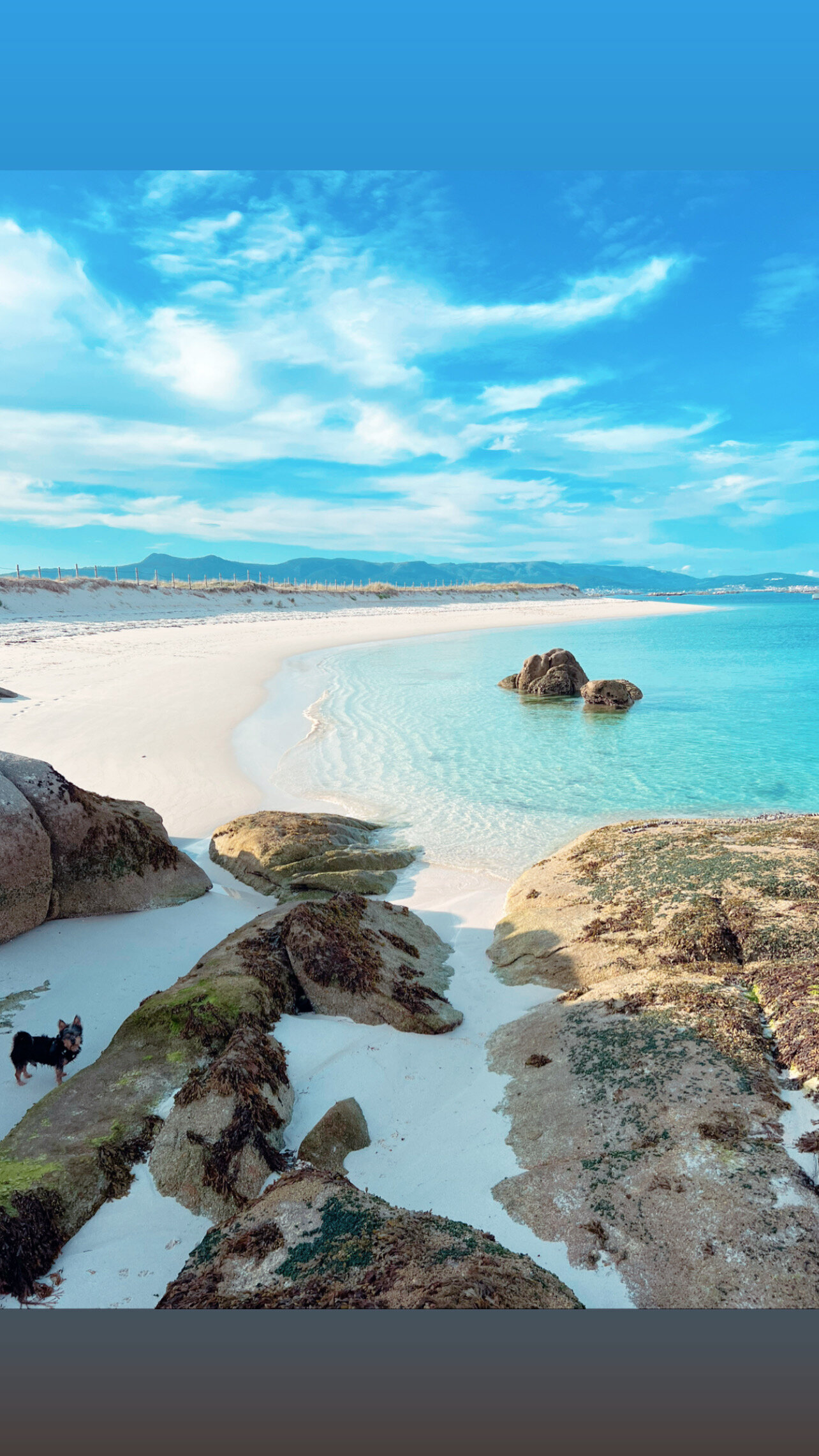
The Areoso: the surprise
10 minutes from the lighthouse, heading south via the west face, you reach the Areoso: the floating sand tongue that only emerges at low tide. Probably Galicia's most photographed spot and yet not on every guide. (Dedicated guide.)
Return through the rafts at sunset
The return to Vilanova port, at sunset, sailing through the rafts with the sun dropping behind Mount Siradella, is the most beautiful moment of the day. Bateas look black against golden water, seagulls fly home, the boat moves slow.
Almost all our guests agree: the return is what they take home.
Trip duration
- Vilanova → Areoso via Punta Cabalo: 45 min effective navigation.
- Return with stops: a half-day (4 h) trip covers this with time for swimming + SUP + snorkel.
- Full day (8 h) adds lunch on the island, Cortegada extension and relaxed return.
Booking
€300 half day / €500 full day, up to 6 guests + skipper, fuel extra. WhatsApp +34 685 74 24 20.
This crossing is the most concentrated way to understand what the Rías Baixas are: mussel rafts, lighthouses, wild coves, gastronomy on return, living fishing tradition. 4 hours give you the essence. 8 hours, the full version.
Ready to experience the Arousa estuary onboard?
Full day €500 · half day €300 · fuel extra. Book on WhatsApp and we confirm in under 4 hours.
Book by WhatsApp

